Features From the Issue
-
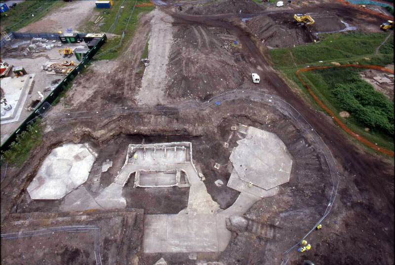
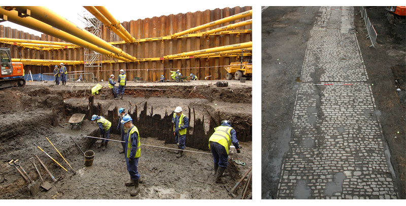
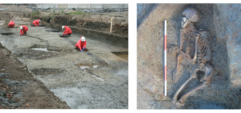
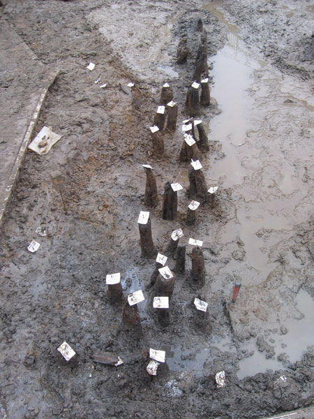
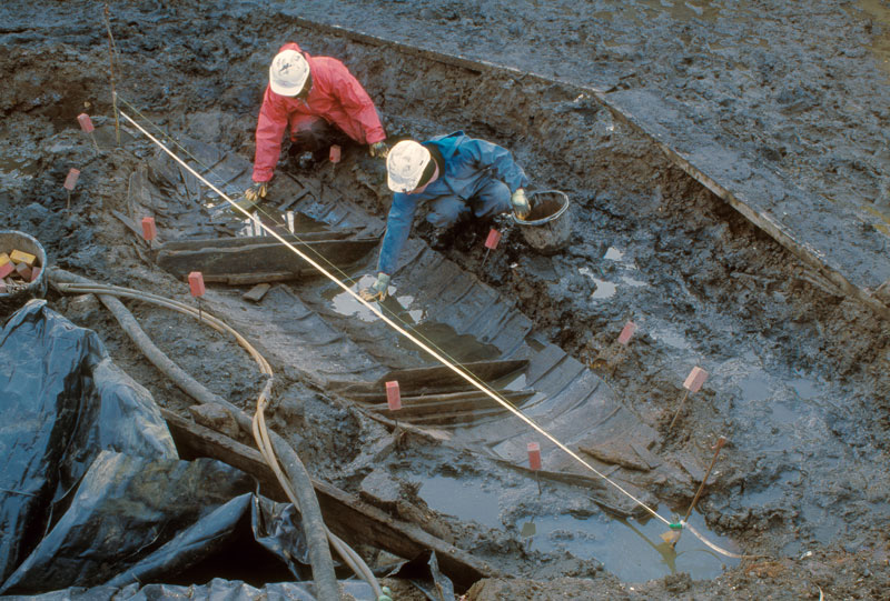
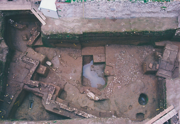
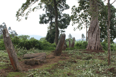
London 2012
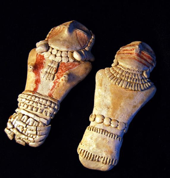
Neolithic Rituals
 (Courtesy The Museum of London and Pre-Construct Archaeology)
 -
Features
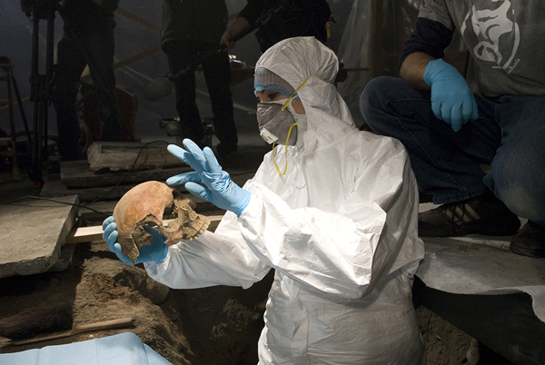
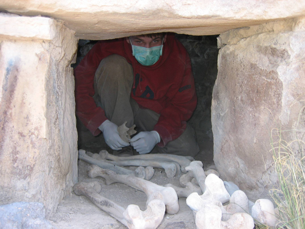
Tomb of the Chantress
A newly discovered burial chamber in the Valley of the Kings provides a rare glimpse into the life of an ancient Egyptian singer
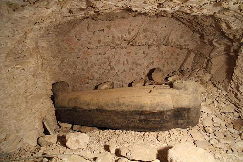 (Courtesy © University of Basel Kings' Valley Project)
 -
 (Courtesy The Museum of London and Pre-Construct Archaeology)
 -
 (Courtesy The Museum of London and Pre-Construct Archaeology)
 -
London 2012
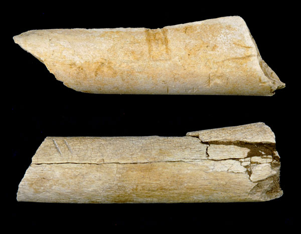
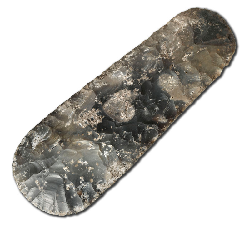
Prehistoric Lives
 (Courtesy The Museum of London and Pre-Construct Archaeology)
 -
 (Courtesy The Museum of London and Pre-Construct Archaeology)
 -
London 2012
A 19th-century Speed Boat
 (Courtesy The Museum of London and Pre-Construct Archaeology)
 -
Features
Automated Site Mapping
Computational analysis of satellite images detects previously overlooked human settlements
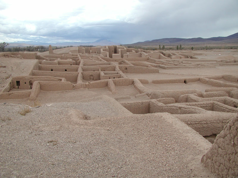
Letter from Mexico
Letter from Mexico
Archaeology, Interrupted
An archaeologist's daughter surveys the rich cultural heritage of northern Mexico—and the impact of violence on researchers working there
Artifact
Artifacts
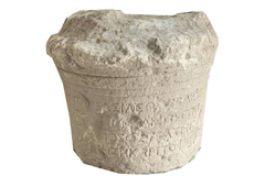
Anglo-Saxon Pectoral

Digs & Discoveries
-
Digs & Discoveries
Athens Murder Court
-
Digs & Discoveries
Preacher-Swordsman-Turncoat
-
Digs & Discoveries
The Origins of Domestic Cattle

-
Digs & Discoveries
Investigating a Decades-Old Disappearance
-
Digs & Discoveries
The Pilling Collection
-
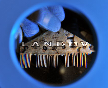
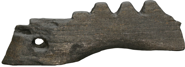
Digs & Discoveries
How Do You Say "Comb" in West Germanic?
-
Digs & Discoveries
A Little Scottish Ditty
-
Digs & Discoveries
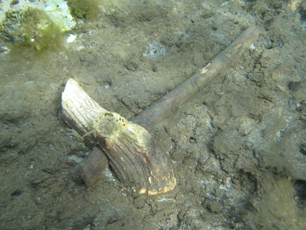
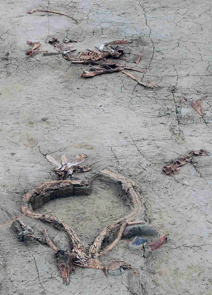
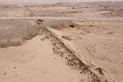
Beachcombing in the Mesolithic
Mesolithic artifacts found submerged at Horsens Fjord in Denmark.
-
Digs & Discoveries
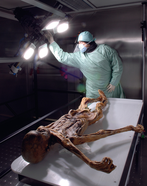
What Ailed the Iceman?
-
Digs & Discoveries
Butchering Big Game
Recent finds and analyses of remains of extinct megafauna—including a massive ground sloth and juvenile mammoth—have stories to tell about how early humans secured and butchered these long-gone species.
-
Digs & Discoveries
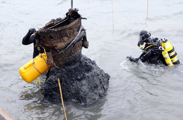
Roman Ship's Secret Cargo
Italian archaeologists have uncovered evidence of smuggling between North Africa and Italy on a third-century a.d. shipwreck off the west coast of Sicily. The most complete Roman ship ever found, the 52-by-16-foot merchant vessel was carrying amphorae filled with walnuts, figs, olives, wine, oil, and fish sauce from Tunisia to Rome when it sank.
-
Digs & Discoveries
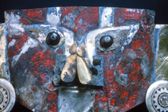
Dawn of the Aztecs, Written in Stone
-
Digs & Discoveries
V-2 Rocket from the Muck
-
Digs & Discoveries
We Didn't Start the Fire... Homo erectus Did
Around the World
Explore
-
IRAQ

-
PERU
-
ETHIOPIA
IRAQ
IRAQ: Understanding the climate of the past often helps with interpretation of archaeological discoveries. A review of ancient documents written between A.D. 816 and 1009 reveals a pattern of unusual weather occurrences in Baghdad, particularly cold-weather events such as hailstorms, frozen rivers, and snow during a certain period of the 10th century. Although it snowed in Baghdad in 2008, such cold snaps are rarer today.
Related Content
Around the World January/February 2021
IRAQ
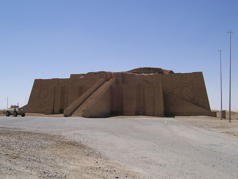
Letter from Iraq March 1, 2011
The Ziggurat Endures
An American soldier reflects on his experience at the ancient city of Ur
PERU
PERU: Some pre- Columbian South Americans lived in groups called allya and buried their dead together in monuments called chullpas. At the site of Tompullo 2, scientists gathered genetic material from six chullpas to determine how the people in each were related. Results show that the ancient Andeans are closely related to modern ones, and that chullpas were family graves based around a male lineage, suggesting allya were structured the same way. But not necessarily— one grave contained the remains of three related men with different paternal lineages.
Related Content
ETHIOPIA
ETHIOPIA: Dating to around 3.4 million years ago, foot bones show that Australopithecus afarensis—"Lucy" and her kin—had company. The new foot appears to be substantially different from an A. afarensis foot. Where Lucy had feet adapted to more-or-less humanlike walking, this new hominin would have been adept at climbing trees. Until now, A. afarensis was thought to be the only hominin in the region at the time.
Related Content
Around the World March/April 2022
ETHIOPIA
Digs & Discoveries November 1, 2010
The World's First Butchers?
Paleoanthropologists in Ethiopia may have discovered the earliest evidence of stone-tool use.